CLAIM-SIGNAL
Satellite-Based Mineral Screening & Claim Due Diligence
See the signals. Prioritize the ground.
Schultz Resource Management, PLLC
Professional reconnaissance screening for mining claim owners and prospective purchasers.
Claim-Signal.com
A better starting point before boots hit the ground
Traditional reconnaissance can consume an entire day before the strongest areas are even recognized.
One Claim
A ranked shortlist of field targets
Satellite screening compares surface mineral signatures across the full claim and identifies zones that stand out from their surroundings. The result is not a gold prediction. It is a practical reconnaissance tool that helps direct limited field time, sampling, and follow-up work.
Narrow the search area
Move from broad acreage to specific coordinates.
Prioritize field checks
Visit the strongest candidates first.
Document the reasoning
Receive maps, rankings, methods, and limitations.
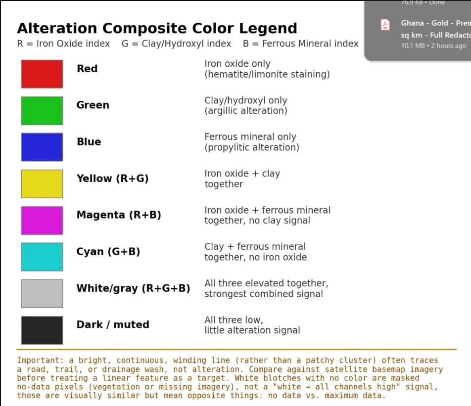
Three alteration indices reveal patterns worth checking
The analysis combines multiple dates of Sentinel-2 imagery, reduces noise, masks vegetation, and compares three surface mineral signatures.
Iron Oxide
Highlights hematite and limonite staining commonly associated with oxidation and weathered mineralized ground.
Clay / Hydroxyl
Highlights argillic alteration signatures that may mark hydrothermal fluid interaction at the surface.
Ferrous Mineral
Highlights ferrous mineral signatures associated with propylitic alteration and related mineral assemblages.
The strongest target is not simply the brightest pixel.
Candidate zones are filtered for terrain practicality and ranked statistically against the surrounding background.
Professional screening technique. Plain-language reporting.
Familiar terrain becomes a mineral-screening map
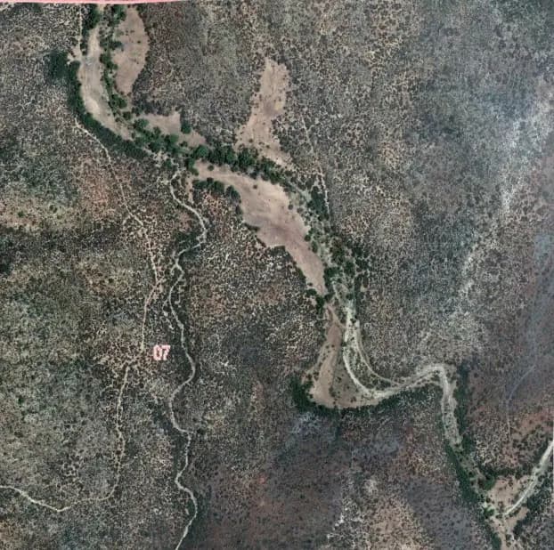
The same claim area is viewed first as recognizable ground, then as a three-channel alteration composite.
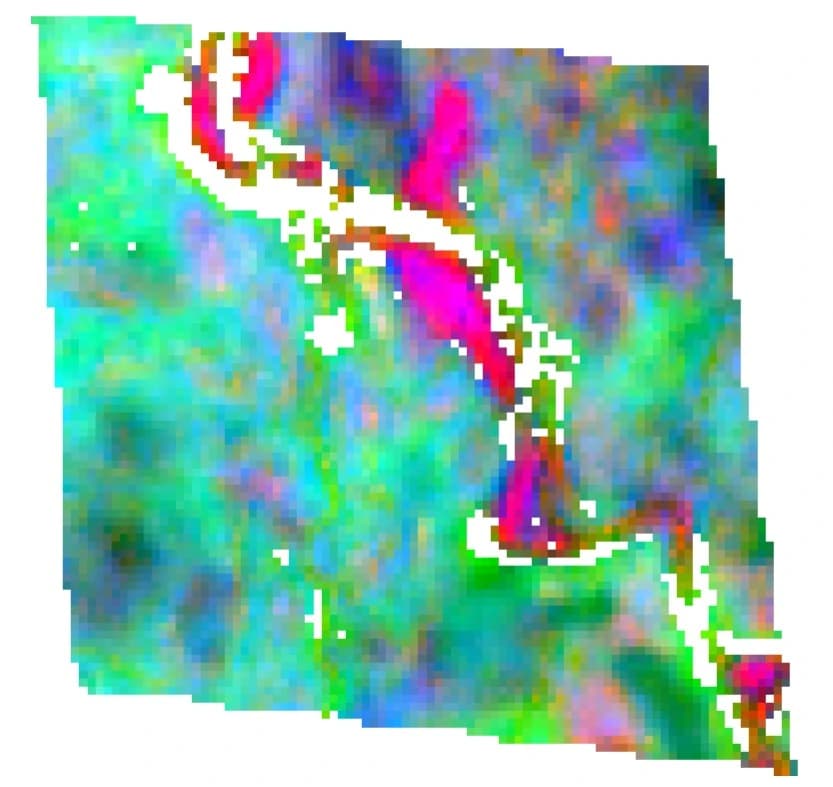
The report makes this comparison usable by pairing the map with ranked zones and GPS coordinates for field verification.
A complete report, not a raw satellite data dump
Executive summary
A plain-language explanation of the screening result, data sources, methodology, and major observations.
Full-color alteration map
A claim-scale composite with a legend explaining the iron oxide, clay/hydroxyl, and ferrous mineral channels.
Ranked target table
Candidate zones prioritized by relative signal strength, with GPS coordinates ready for a mapping app or field GPS.
Supporting context
Space for field photographs, historic maps, assay information, or other client-provided reference material.
Clear limitations
A direct statement of what satellite screening can and cannot establish, so the report is not misread.
Claim due diligence review
Before committing to a claim, whether staking it yourself, buying one, or evaluating a deal someone brought to you, there's a whole set of questions that have nothing to do with what's in the ground and everything to do with whether you can actually access, permit, and legally hold it. We research those questions systematically:
Claim status and title
Active standing, fees current, overlapping or conflicting claims, patented vs. unpatented status.
Land status and regulatory review
Which agency governs the ground (BLM, Forest Service, state, private), withdrawn lands, environmental designations, and the permitting tier that applies.
Access and rights
Surface vs. mineral rights, legal access vs. physical access, water rights.
Historical and neighboring claims research
Prior production or exploration on the claim, and who holds and is doing what on the ground around it.
Site logistics
Road access, power, proximity to a mill or processing facility.
Encumbrances
Existing royalties, liens, or other obligations that would transfer with the claim.
From claim boundary to field-ready targets
Provide the boundary
Send a KMZ, GeoJSON file, or claim corner coordinates.
Run the screening
Multi-date imagery is processed, masked, filtered, and ranked.
Receive the report
Get the PDF map, target table, coordinates, methods, and limitations.
Verify in the field
Inspect, photograph, sample, and involve a licensed geologist when appropriate.
Typical turnaround: 24 hours
Longer schedules are communicated in advance when workload, field assignments, or project complexity require it.
Claim-Signal | Schultz Resource Management, PLLC
Better intelligence for the next field decision
$500
Per Scan
Up to one section — 1 mile x 1 mile
Typical delivery in 24 hours
Satellite Screening
$500 per scan (up to one section, 1 mile x 1 mile). Typical delivery in 24 hours.
If multiple claims fall within that section, you're not charged per claim — one scan, one price, covers them all.
Due Diligence Review
Project pricing, negotiable based on scope.
Combined Package
$500 per scan, plus project pricing for due diligence, negotiable.
What this is not
Satellite imagery cannot establish gold grade, tonnage, depth, or economic value. Every candidate zone requires field verification, physical sampling, and appropriate professional review before informing an investment or transaction decision.
This service is a preliminary screening tool. It is not a resource estimate, geological opinion, NI 43-101 report, S-K 1300 report, or substitute for professional geological work. The due diligence review is a research summary based on available public records, not a legal opinion or title guarantee, and does not replace a licensed attorney's review before a transaction closes.
Claim-Signal Brochure
The full satellite mineral alteration screening overview, as a PDF.
See the signals. Prioritize the ground.